Back
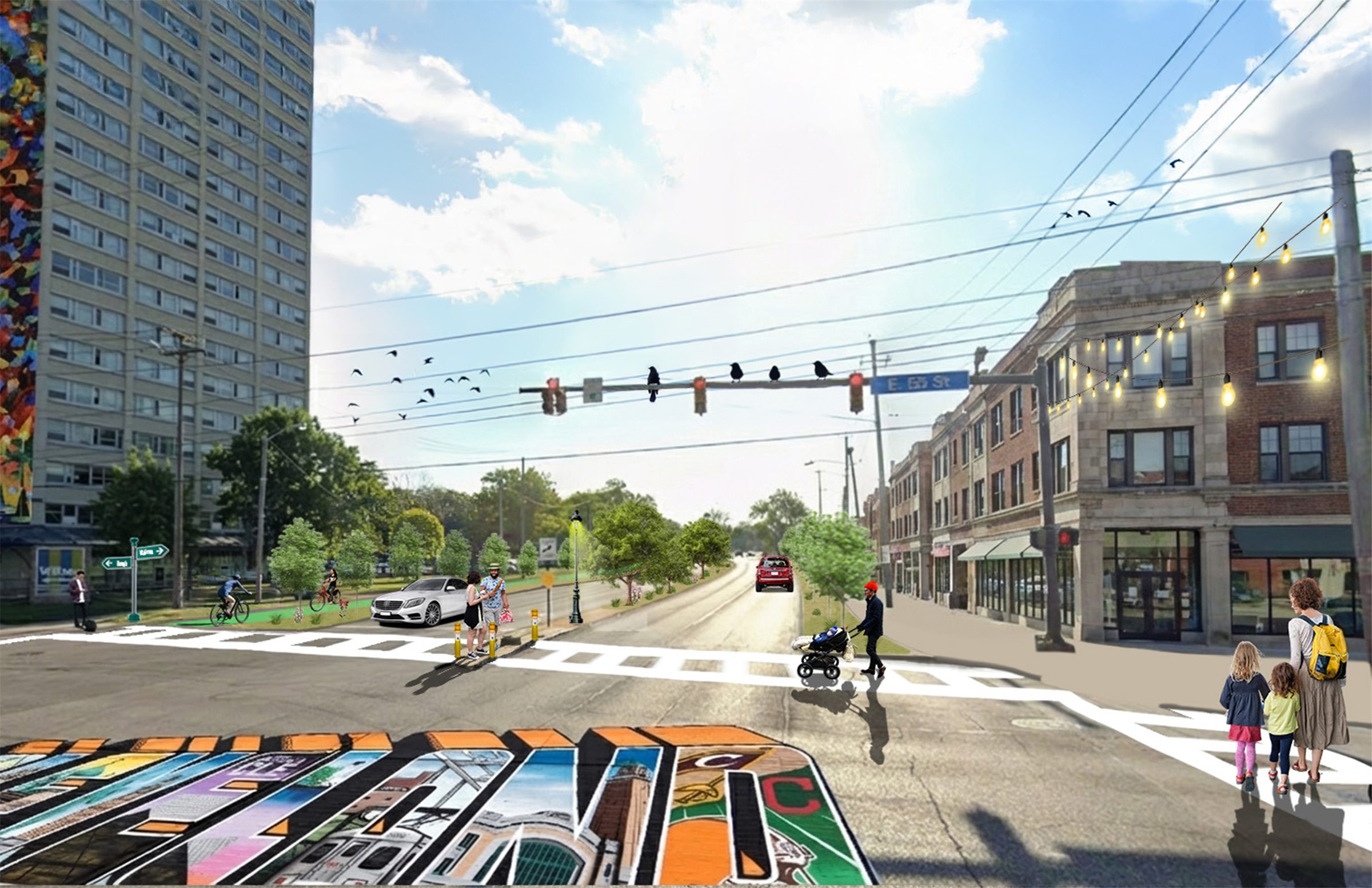
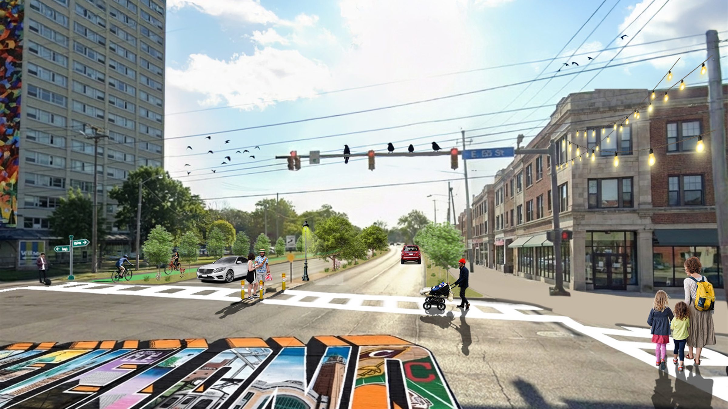
Rendering of Chester Avenue at East 55th Street: a painted crosswalk mural, a protected green bike lane, street trees, and people walking and cycling past shops and a tall apartment tower.

Reconnecting Across Chester Avenue

  • Urban Design Workshop
  • Cleveland, Ohio
  • Fall 2025

Collaborators: Nikhil Matthew

Access Full Deck ->
More

Chester Avenue is a six-lane scar of urban renewal that prioritizes commuter speed over neighborhood connectivity. The corridor divides Hough residents from Midtown’s community anchors while encouraging suburban strip development and creating dangerous conditions for pedestrians and cyclists.

Despite AADT volumes declining by 8,000 since 2016, Chester remains unsafe. Over the same period, the first half-mile alone has seen over 100 crashes, with 31 causing injury and 1 being fatal. Many parcels along the corridor are either vacant or contain poorly maintained buildings, but public and non-profit land ownership provides opportunities for new development.

This project proposes a complete road diet with protected bike lanes, pedestrian refuge islands, and expanded green buffers. Three strategic development sites totaling 15 acres introduce affordable housing, street-activating retail, and community spaces that transform Chester from a dividing edge into a neighborhood connector.

Neighborhood Context

Contribution

With partner Nikhil Matthew, I developed neighborhood connectivity strategies across three development sites in Zone 1. I also led the corridor-wide Chester Avenue redesign discussions for all four project teams and presented the final proposal to project partners.

Study Area
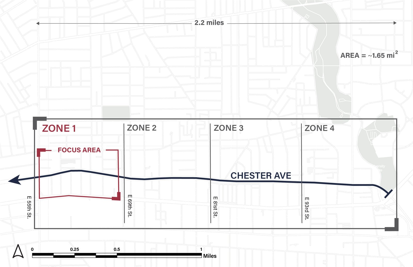
Study area map: 2.2 miles of Chester Avenue split into four zones between East 55th and East 93rd Streets, with the focus area at the west end of Zone 1.

Focus Area

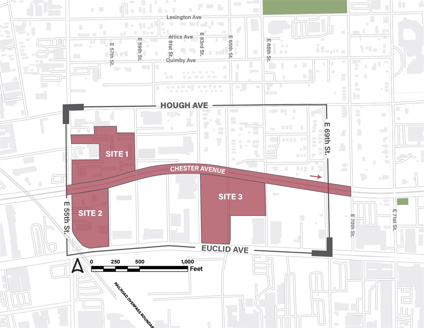
Focus area map: three development sites along Chester Avenue between East 55th and East 69th Streets, bounded by Hough Avenue to the north and Euclid Avenue to the south.

Safety Analysis

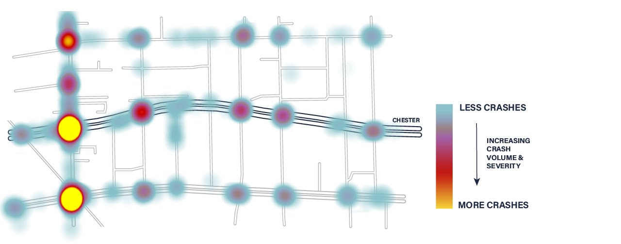
Crash Heatmap

Crash heatmap: the most crashes cluster where East 55th Street meets Chester and Euclid Avenues, with smaller hot spots at other Chester intersections.

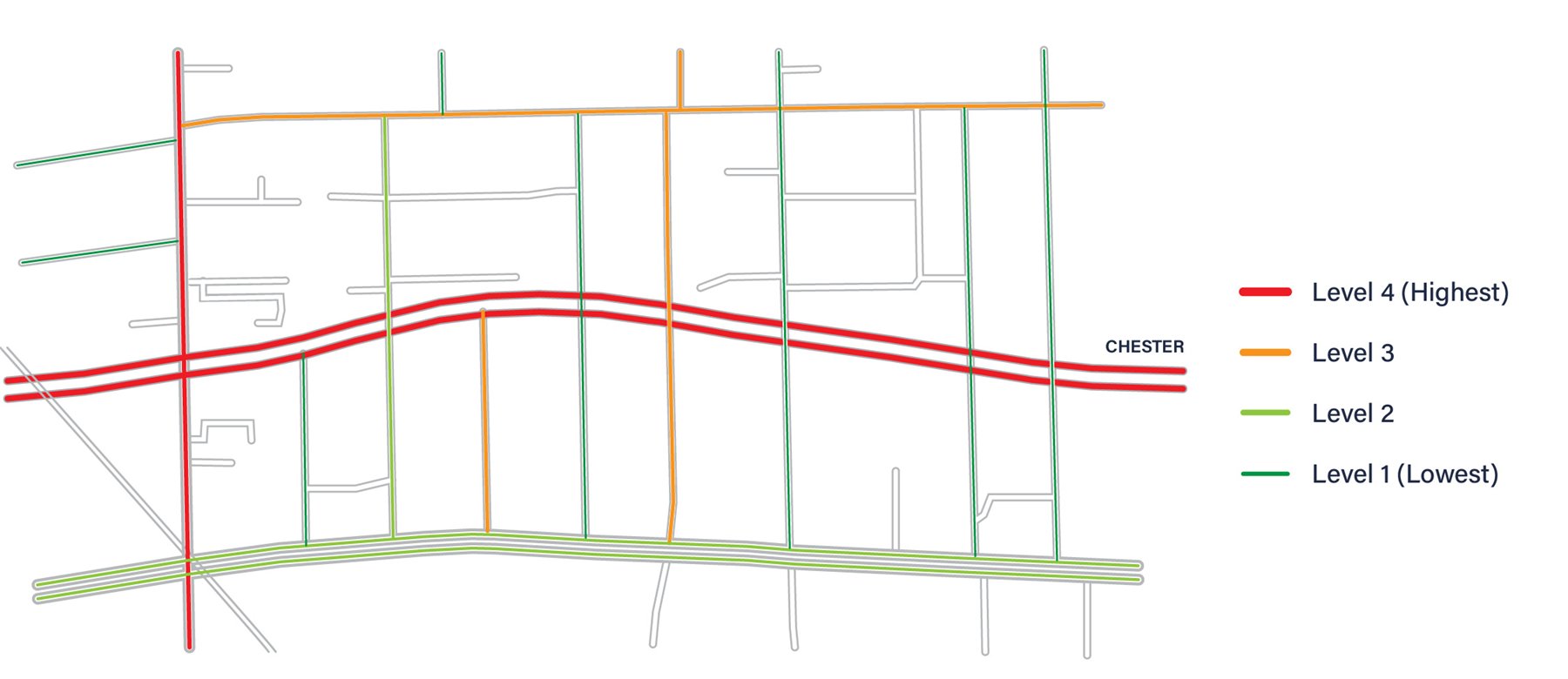
Biking Level of Stress

Biking level of stress map: Chester Avenue and East 55th Street are level 4, the highest; most side streets are levels 1 and 2.

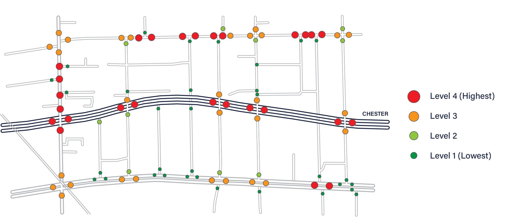
Crossing Level of Stress

Crossing level of stress map: most crossings of Chester Avenue are level 4, the highest, while side street crossings are mostly levels 1 and 2.

Streetscape

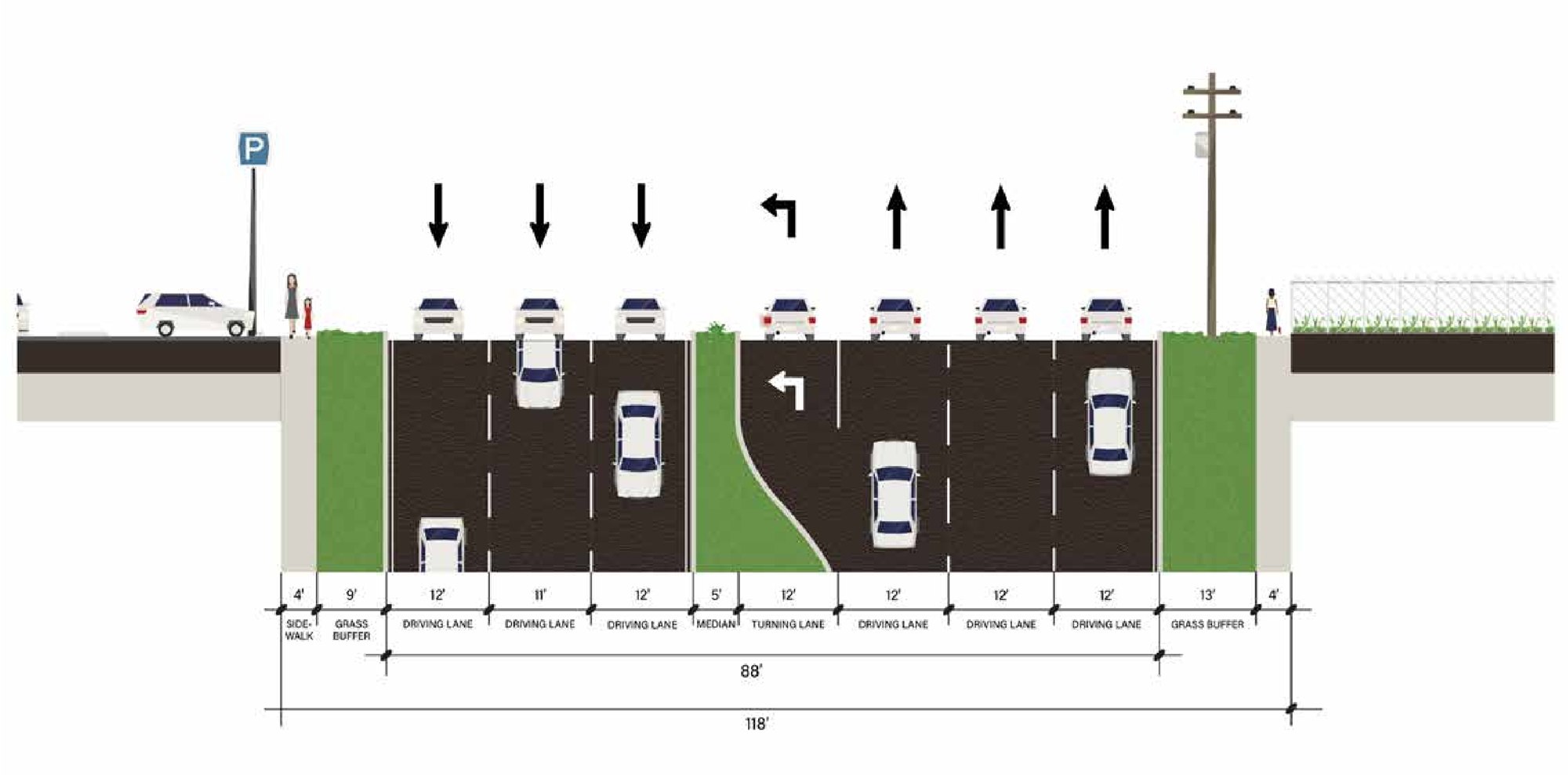
Existing Streetscape

Section of the existing Chester Avenue: 118 feet wide, with seven driving and turning lanes, a narrow median, grass buffers and four-foot sidewalks.

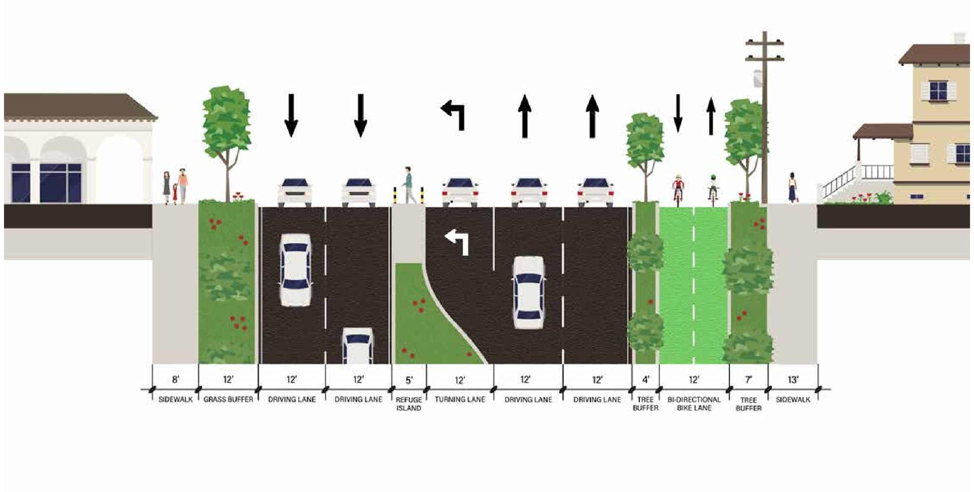
Proposed Streetscape

Section of the proposed Chester Avenue: five driving and turning lanes, a pedestrian refuge island, a twelve-foot bi-directional bike lane between tree buffers, and wider sidewalks lined with shops and homes.

Site Plans

Site 1: Wilson Living Center
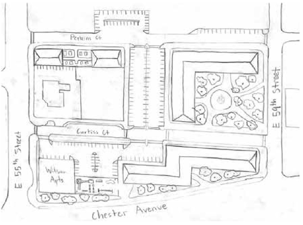
Pencil sketch of the Site 1 plan between East 55th and East 59th Streets.
  • Centralize community spaces and rehab youth baseball field
  • Provide at least 30% affordable townhomes and MF apts
  • Connect 55th to 59th for connectivity and additional parking
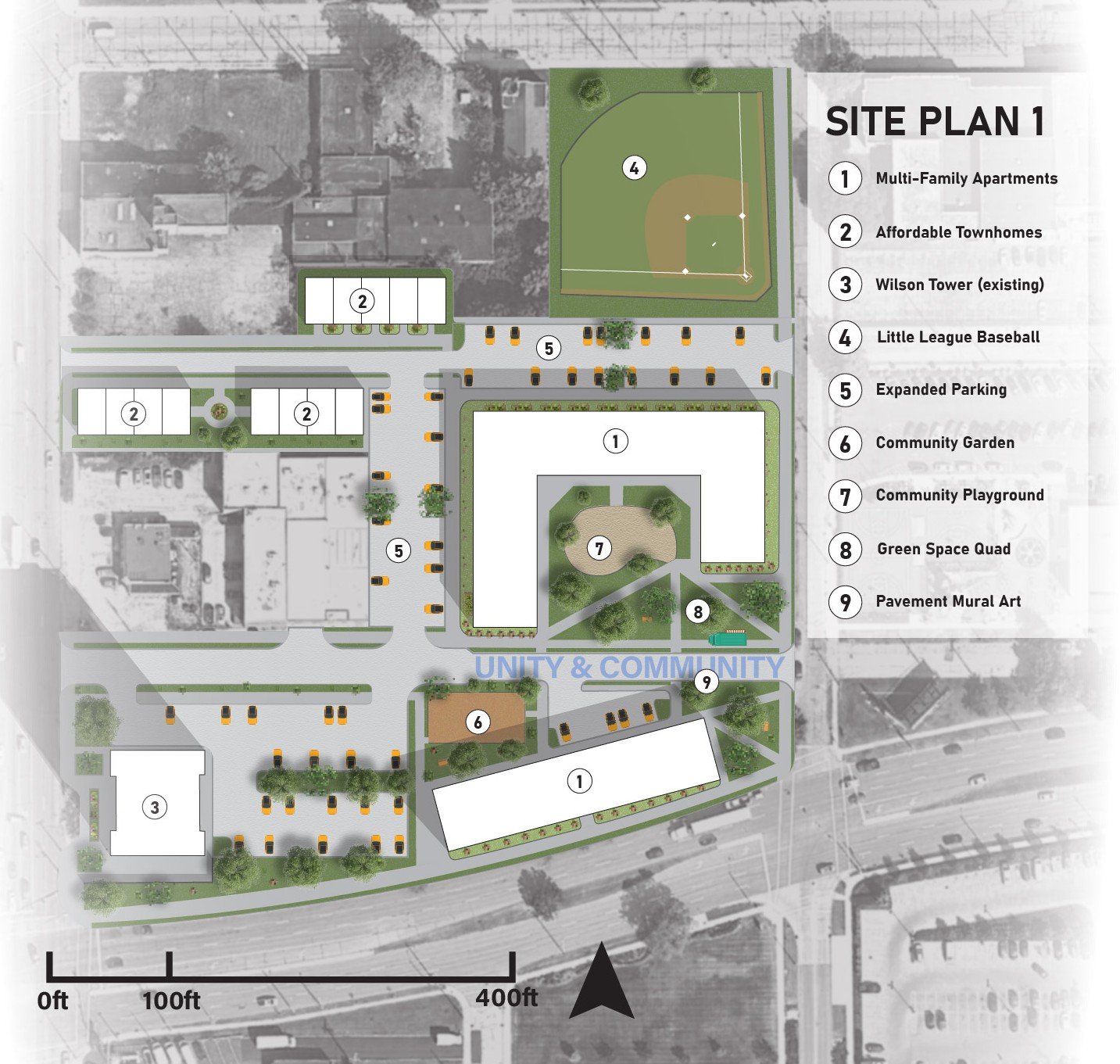
Site Plan 1, key: 1 multi-family apartments, 2 affordable townhomes, 3 Wilson Tower (existing), 4 Little League baseball, 5 expanded parking, 6 community garden, 7 community playground, 8 green space quad, 9 pavement mural art.

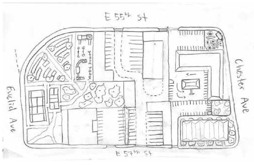
Site 2: Mixed Use Hub at 55th

Pencil sketch of the Site 2 plan, bounded by East 55th Street, Chester Avenue, East 57th Street and Euclid Avenue.
  • Relocate U-Haul for mixed commercial on Chester & 55th
  • Retain light industrial uses while providing townhomes on 57th
  • Use blank facades for local art, particularly the back of Kram Kram
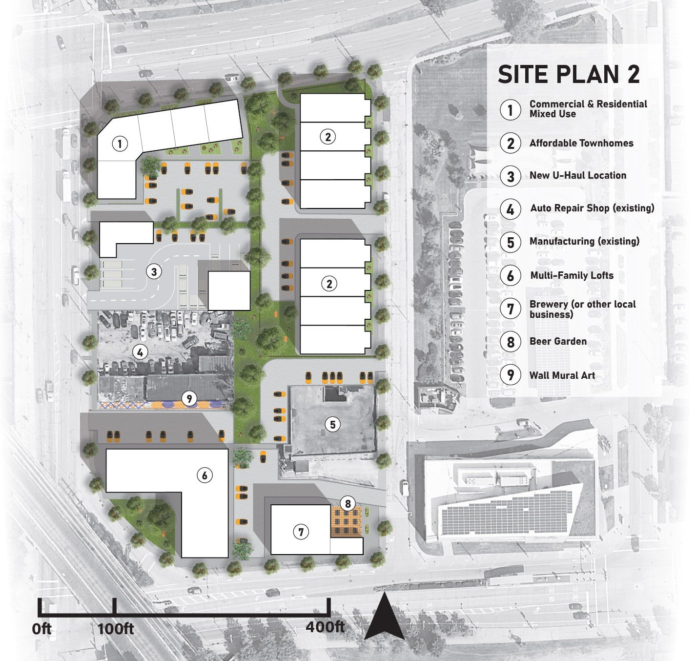
Site Plan 2, key: 1 commercial and residential mixed use, 2 affordable townhomes, 3 new U-Haul location, 4 auto repair shop (existing), 5 manufacturing (existing), 6 multi-family lofts, 7 brewery (or other local business), 8 beer garden, 9 wall mural art.

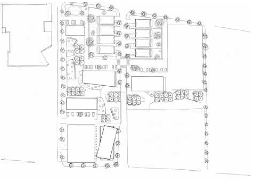
Site 3: Dunham Green Corridor

Pencil sketch of the Site 3 plan, with rows of modular homes, shops and trees.
  • Honor Hough’s history through a new Black Avenue Center
  • Compliment the Dunham plan with mom-and-pop shops
  • Provide affordable housing through modular prefab homes
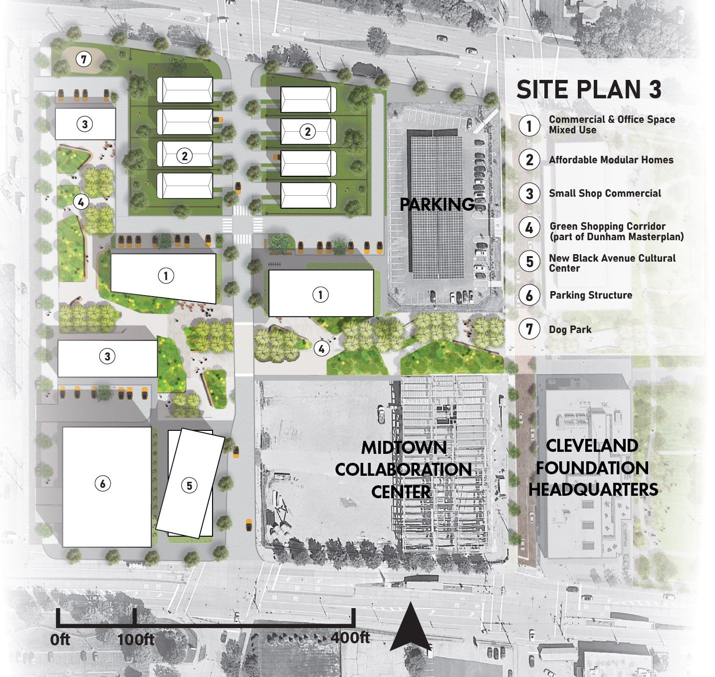
Site Plan 3, key: 1 commercial and office space mixed use, 2 affordable modular homes, 3 small shop commercial, 4 green shopping corridor (part of Dunham masterplan), 5 new Black Avenue Cultural Center, 6 parking structure, 7 dog park; beside the Midtown Collaboration Center and Cleveland Foundation headquarters.

Connectivity Masterplan

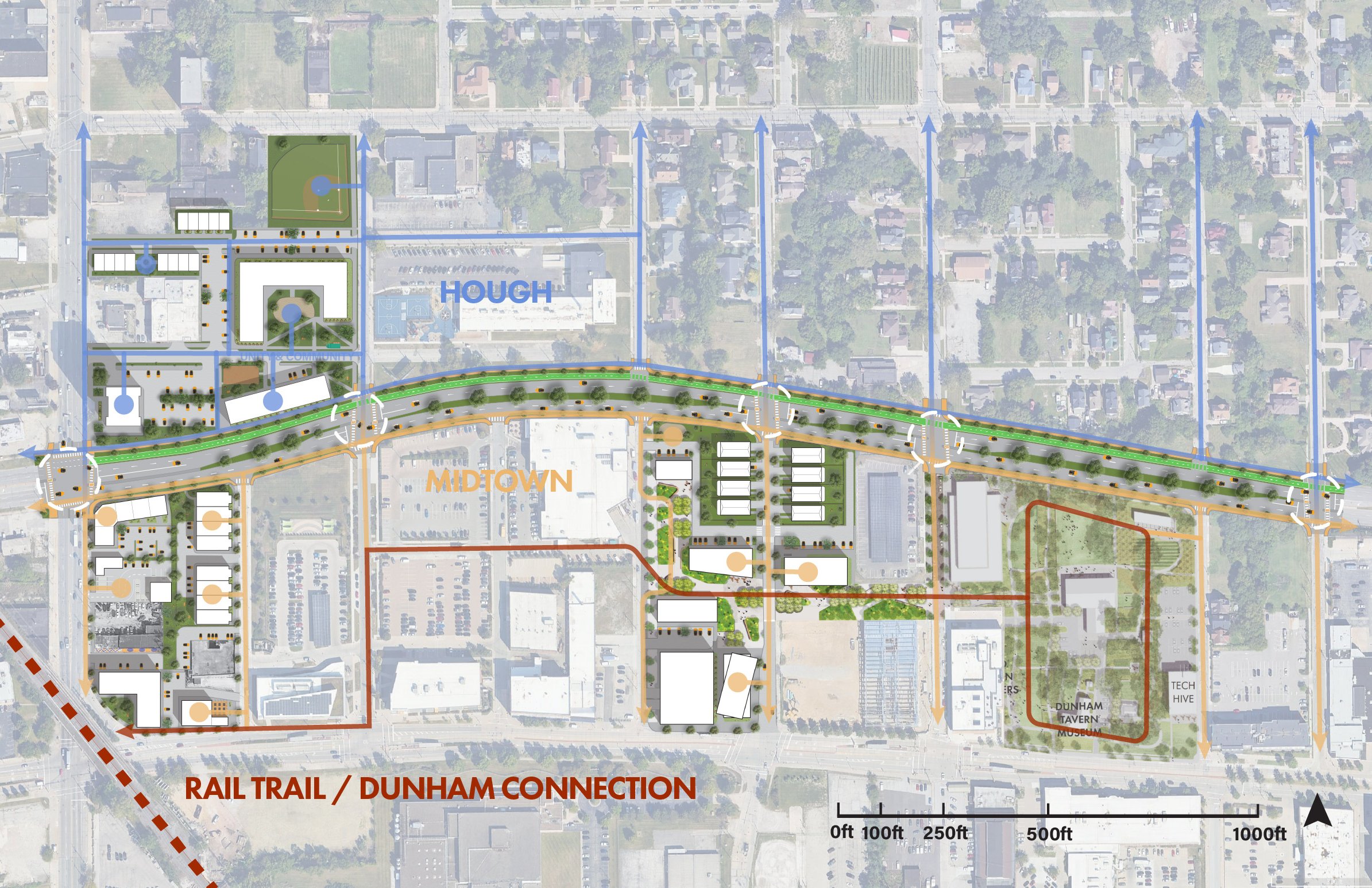
Masterplan of the three sites along the redesigned Chester Avenue: blue routes link the sites north into Hough, orange routes link them south into Midtown, and a rail trail connects to the Dunham Tavern Museum grounds.

Chester Avenue & 55th Street

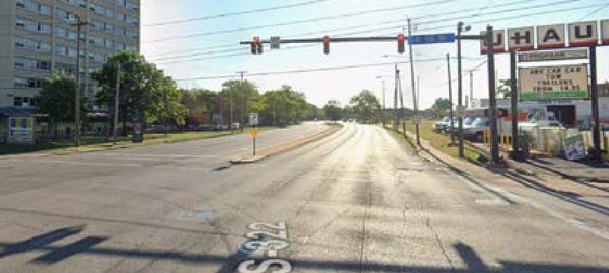
The wide, empty intersection of Chester Avenue and East 55th Street, with a U-Haul lot on the corner.
Before
The same intersection with a painted crosswalk mural, a protected bike lane, street trees and new shops.
After

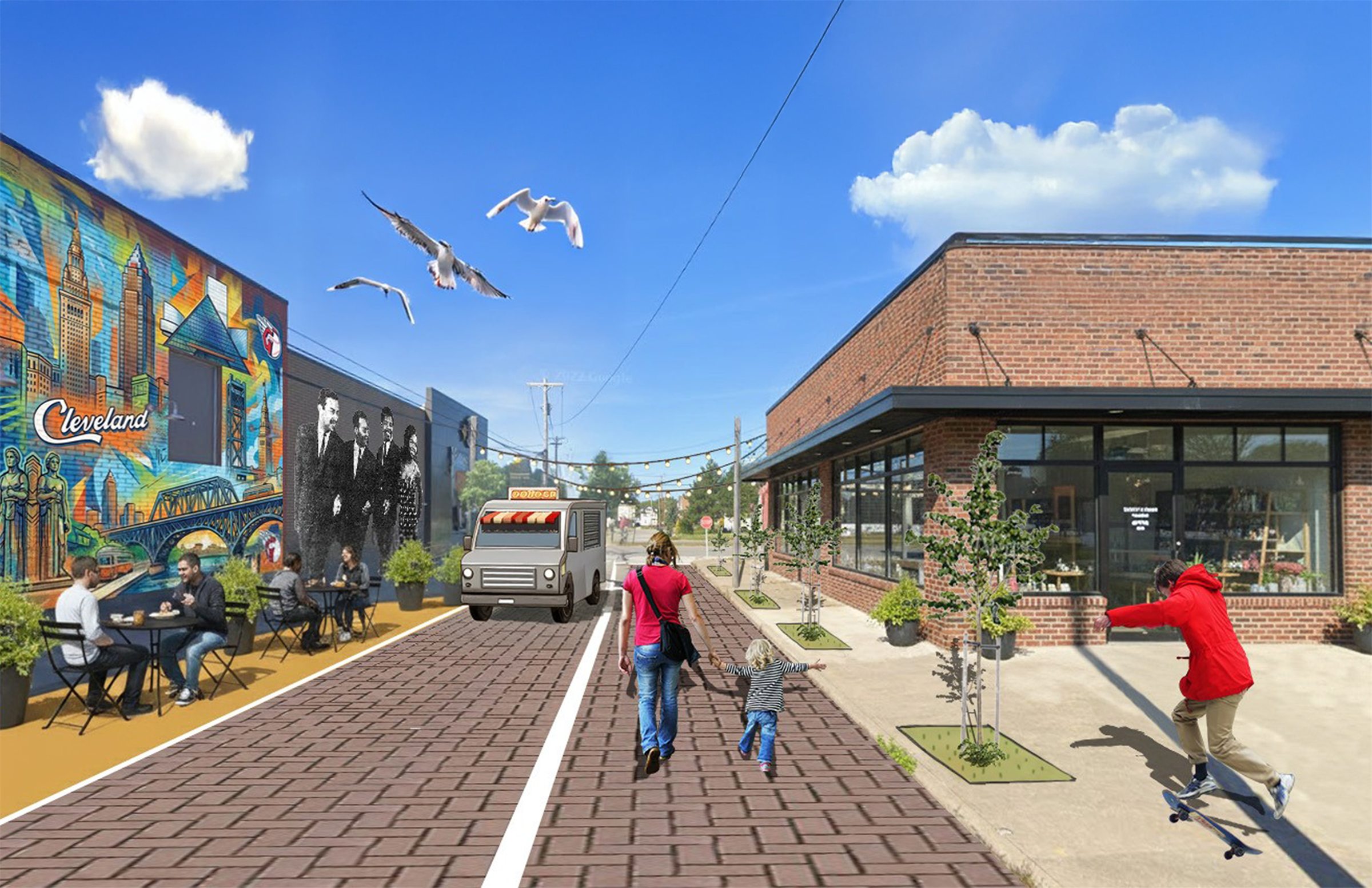
Chester Avenue & 63rd Street

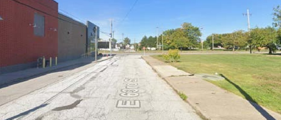
East 63rd Street off Chester Avenue, a bare road between a blank brick wall and an empty lawn.
Before
A brick-paved street with a Cleveland mural on the wall, café tables, a food truck, string lights, and people walking and skateboarding past a new shop.
After

Access Full Deck ->